
Hyperspectral satellites capture hundreds of color bands per pixel
Summary
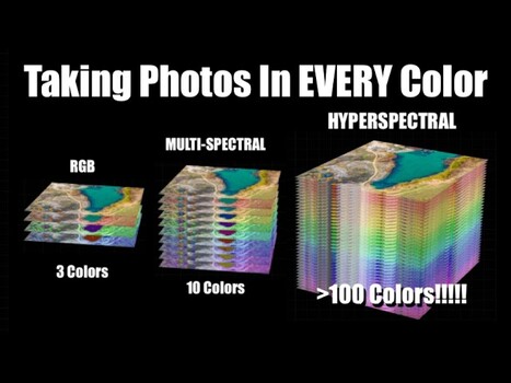
Hyperspectral satellites are advancing remote sensing by capturing hundreds of distinct wavelength bands per pixel, far beyond the three color channels of human vision. This allows for the identification of specific vegetation types, minerals, and camouflage that appear identical to the naked eye but possess different spectral signatures. The engineering challenge lies in capturing this three-dimensional data (hundreds of color layers) with two-dimensional sensors, with methods like push broom imaging and various snapshot techniques being employed.
Key points
- Hyperspectral satellites capture hundreds of color bands, revealing details invisible to RGB cameras.
- This technology enables identification of specific materials based on their unique spectral signatures.
- Engineering challenges involve capturing 3D spectral data with 2D sensors.
- Applications range from agriculture and mineral identification to military surveillance.